Technical foundation built for standardized, ongoing California coastal habitat mapping
A group of scientific experts co-facilitated by SCCWRP has developed the technical foundation for standardizing how coastal habitats get mapped across California – a key milestone in California’s ongoing efforts to build statewide capacity to routinely generate high-quality maps that can support assessments of the health of coastal habitats.
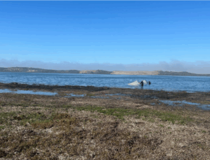
The six month-long project, described in a technical report published in September, relied on four sets of expert advisory panels to develop best-practices recommendations for how to overcome the fragmented, time-consuming, inconsistent process by which coastal managers create detailed habitat maps of California’s rocky intertidal areas, coastal wetlands/estuaries, eelgrass beds, and beaches and dunes.
Traditionally, habitat mapping has been done for individual habitats on an as-needed basis in a specific area. As a result, it is not uncommon for habitat assessment programs and projects to divert up to 10% of their budget to support development of maps that delineate the boundaries of the habitat area being monitored.
By contrast, the coordinated mapping program that is envisioned by the expert panelists would ensure managers statewide have access to continuously updated habitat maps produced using consistent, best-practices methods. The improved habitat maps – which mapping experts estimate might cost California about $500,000-$700,000 annually to maintain – would enable more robust, comprehensive ecological health assessments.
The development of the statewide mapping guidance began in fall 2024, when SCCWRP and the San Francisco Estuary Institute convened four expert advisory panels to discuss priority objectives, potential cost-effective approaches, and other key technical needs associated with implementing rigorous, periodic mapping for California’s coastal habitats.
Each panel focused on one of four coastal habitats – rocky intertidal areas, coastal wetlands/estuaries, eelgrass beds, and beaches and dunes – that collectively make up all of the major habitat types spanning the California coast. Indeed, every coastal area of California can be either classified into one of the major habitat types, or a blend of one or more of these habitat types.
If California moves forward with the experts’ statewide habitat mapping recommendations, the maps could be immediately adopted and used to support diverse coastal monitoring and management programs, including to monitor the long-term resiliency of coastal habitats to sea level rise and climate change, track progress toward California’s goal to conserve 30% of California’s land and coastal waters by 2030, and support how managers respond to emergencies such as coastal flooding and extreme high tides.
In Southern California, the Southern California Bight Regional Monitoring Program could use the maps to conduct more comprehensive regional assessments of the health of coastal habitats like ecologically fragile eelgrass beds. For example, because California presently lacks comprehensive eelgrass habitat maps, Bight ’23’s ongoing Submerged Aquatic Vegetation study element was limited to assessing the health of only the eelgrass beds in the region that have already been mapped; moreover, the Bight ’23 eelgrass assessment won’t be placed into a statewide or regional context, given the lack of comprehensive eelgrass maps.
The panelists’ recommendations cover how to define habitat boundaries, topography and relationships to adjacent habitats, as well as how to collect and analyze data, and produce annual updates to maps in a routine and cost-effective manner. The recommendations could guide California agencies in developing detailed standard operating procedures (SOPs) and training programs. The mapping guidance also could be used as a jumping-off point for pursuing standardized, ongoing mapping of inland aquatic habitats.
For more information, contact Dr. Eric Stein.
More news related to: Climate Change, Regional Monitoring, Sea Level Rise, Top News