Committee formed to advance use of satellite imaging for HABs monitoring
SCCWRP has convened a technical advisory committee to develop best-practices guidance for using satellite imaging data as a routine management tool to detect and monitor harmful algal blooms (HABs) in California lakes and reservoirs.
The committee, convened in December, will explore how to develop quality-assurance safeguards that improve management confidence in satellite imaging data as a decision-making tool.
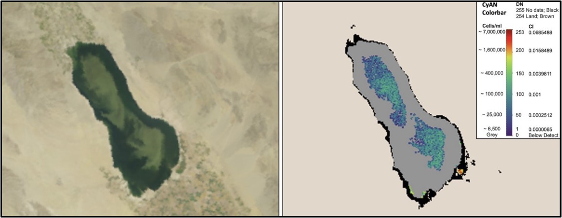
Satellite remote sensing data have the potential to provide a viable, cost-effective way to generate a continuous stream of real-time HABs monitoring data. In 2022, SCCWRP and its partners successfully used satellite imaging data to build a comprehensive portrait of when and where HABs have been occurring in California’s large lakes and reservoirs over the past five years.
To date, managers have been reluctant to use satellite imaging as a HABs monitoring tool because of a lack of quality assurance information about the imaging data.
More news related to: Eutrophication, Harmful Algal Blooms