Demonstration maps reveal extrapolation limits of stream condition scores
SCCWRP has generated a series of maps that reveal the geographical extent to which ecological condition scores calculated for stream sampling sites may be extrapolated to unsampled reaches upstream and downstream of the sites.
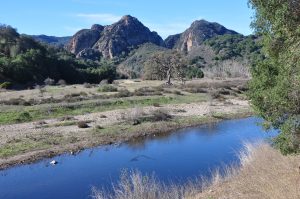
The maps, which cover six demonstration watersheds across California, enable stream managers to get a better sense of the areas where they already have sufficient data to estimate overall ecological condition, and the areas where they should consider more intensive sampling to improve confidence.
A stream bioassessment is typically conducted at only a few locations within a watershed, as stream managers don’t have the resources to conduct bioassessment work along every stream reach in California.
The project, completed in partnership with the California Stormwater Quality Association, is intended to help stream managers optimize how they apply stream bioassessment data to inform decision-making and policy development at larger scales, from subcatchments to entire watersheds.
The project involved the groundbreaking application of a new statistical modeling technique known as spatial stream network (SSN) modeling, plus obtaining the consensus of an expert review panel.
Stream managers are considering expanding the project to explore creating regional and/or statewide maps, as well as to analyze non-CSCI scores such as algal indices of biotic integrity.
More news related to: Bioassessment, Indices of Biotic Integrity